Full Form: Indian Regional Navigation Satellite System
Operational Name: NAVIC (Navigation with Indian Constellation)
Navigation system similar to GPS
Range: India and 1500 Km around India
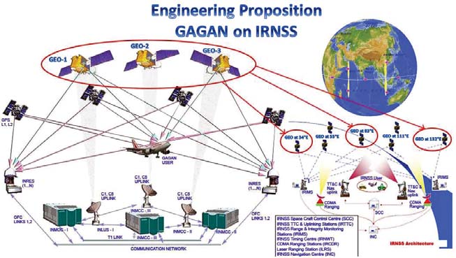
7 Sattelites: IRNSS 1A to IRNSS 1G and a Ground based.
Final Launch: 28.04.2016. Will become operational from June 2016. Developed by ISRO
Cost: 1420 Crore
3 Satellites in GEO(Geo-stationary orbit) and 4 in GSO (Geosynchronous orbit)
Development started because US denied its usage when it was needed (Kargil War 1999). So India decided to have its own navigation system as dependency on others will certainly be harmful.
Two Services it will provide: Standard Positioning Service(SPS) for Common People and Restricted Services (RS) for Authorized Users such as military and government.
The system is intended to provide an absolute position accuracy of better than 10 meters throughout Indian landmass and better than 20 meters in the Indian Ocean as well as a region extending approximately 1,500 km around India
USA's GPS(Global Positioning System) and Russia's GLONASS are the worlds' only currently functional Nav Systems. Thus after June 2016 India will be the third country.
European Unions' Galileo and China's BeiDou are under development.
Comparison with GPS: GPS ranges for entire world with a range of 3-15 Metres at accuracy 95%. It uses 24-32 Satellites
EmoticonEmoticon